University of Newcastle
Type of resources
Topics
Keywords
Contact for the resource
Provided by
Years
Formats
Representation types
Update frequencies
Resolution
-

Soil depth core collected from the Needle’s Eye site in Dumfries, Scotland. Clear plastic depth core was lowered into a bog within the site, excised, and capped at the top and bottom. Core was sliced at 1 cm intervals at the University of Manchester in an anaerobic bag. A total of 42 samples were generated. Soil samples were returned to Newcastle University.
-

Two sediment depth cores were collected from the floor of Loch Etive, near Oban, Scotland. Slicing was performed in an anaerobic bag. Samples were taken at 0.5 cm increment between 0 - 2 cm, 1 cm increments between 2 - 10 cm, and at either 2 or 5 cm increments thereafter. Samples were transferred to Newcastle University for DNA extraction. A total of 21 samples were extracted for core 1, and 23 samples extracted for core 2.
-

Two sediment depth cores were collected from a mud sediment patch at the sea floor of the Irish Sea. Cores were collected by the University of Manchester. Cores were sliced at 1 cm intervals from 0 - 10 cm, and at 2 cm intervals thereafter. Slicing was performed in an anaerobic bag. Samples were transferred to Newcastle University for DNA extraction. A total of 21 samples were extracted for core 1, and 23 samples extracted for core 2.
-

Soil depth core collected from the Needle’s Eye site in Dumfries, Scotland. Clear plastic depth core was lowered into a bog within the site, excised, and capped at the top and bottom. Core was sliced at 1 cm intervals at the University of Manchester in an anaerobic bag. A total of 41 samples were generated. Soil samples were returned to Newcastle University.
-
Terrestrial laser scanning data of the slopes above the A83 Rest and Be Thankful collected by a Riegl LMS Z620i instrument in 2016 after Storms Desmond and Frank from 3 positions. These data are scanner centric coordinates which the end-user needs to align and (if required) align into a global coordinate system. Data are in raw format, supplied as .las with scaled intensity included.
-

Imagery taken with a DJI Phantom 4 Pro drone using the as supplied RGB camera for part of the slopes above the A83 Rest and Be Thankful, Scotland in 2016. Images cover part of the slopes affected by Storms Desmond and Frank.
-
The data was generated from a range of laboratory experiments where a range of silicate rocks (granite, basalt, peridotite) were crushed in oxygen-free conditions, deoxygenated water added, and the generation of hydrogen gas and hydrogen peroxide followed over a week. Results were compared to rock-free controls. The data was collected to provide insight into the production of oxidants (such as hydrogen peroxide) along tectonically active regions of the subsurface, and how the oxidants might influence subsurface microbiology.
-
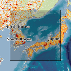
This award was made as a sailing participant of IODP Expedition 346, an international ocean drilling programme that NERC subscribe to. As such there was a lot of data generated that is owned and kept by IODP and which is freely available at: web.iodp.tamu.edu/UWQ/. Published Paper: Integrated Ocean Drilling Program Expedition 346 Scientific Prospectus - Asian Monsoon Onset and evolution of millennial-scale variability of Asian monsoon and its possible relation with Himalaya and Tibetan Plateau uplift. doi:10.2204/iodp.sp.346.2013
-
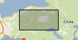
Helicopter borne LiDAR and aerial photo survey of lahar pathways deposited during the April 2015 Volcan Calbuco eruption. Terrestrial Laser Scanning data for July 2015.
-
Data extracted from simulations of rapidly-rotating Boussinesq convection driven by internal heating in a full sphere and published in Guervilly & Cardin, 2017, Geophys. J. Int. 211, 455-471 (DOI:10.1093/gji/ggx315). The simulations were run for Ekman numbers of 1e-7 and 1e-8 and Prandtl numbers of 0.1 and 0.01. The data consist of tables of input and output parameters (Reynolds number of the convective and zonal flows, convective lengthscale and Rhines scale).
 NERC Data Catalogue Service